
The BIG NEWS! - Our River Plan is Live!
And the 2022 WAG AGM will be on 28th June at 5:45 p.m. at the South Wairarapa Working Men’s Club - dining room at the rear. everyone welcome, please join us there, it’s all good news!
scroll down for
News and events for our Waiohine Catchment

We now have a plan that is in use
It will be no surprise that there were some last minute changes and statements about the plan not being binding on them imposed by GWRC but the Project Team are satisfied that the plan intent remains unchanged.
As we have always said, the plan is the start not the end - it is a living plan and will always depend upon the integrity and preparedness to engage and adhere to it of GWRC and everyone else.
To the hundreds of people who positively contributed to the decisions, principles, strategies and content of the plan, a sincere thankyou from the community appointed Project Team - we could not have done it without you all.
Now let’s get on with restoring the mauri of the river and making it safe, affordable, beautiful and naturalistic.

Setting a high standard:
First Walkover since the plan was adopted by GWRC
Using the process defined in the Waiōhine River Plan, mana whenua, Fish & Game, River Scheme Chair, WAG project team and GWRC officers visited sites along the river and discussed success of works agreed on the river, further improvements needed, such as native plantings at the Urupa works site, progressing the protection of the stop bank on the outside (True Right Bank) of Fuller’s Bend and the next phases of naturalisation of the area at the end of Kuratawhiti Street.
The discussions were positive, knowledgeable, complied with the plan principles and most importantly, found consensus solutions. This bodes well for the operation of the plan and the restoration of riparian areas for nature and amenity. Our thanks to everybody out there who has participated in making this possible, it’s something really positive to build on.
Waiohine Action Group (WAG) AGM for 2021
13th February 2022: For those who are interested, this storm has not produced a major flood event. The Waiōhine peaked at 400 cubic metres of water per second (cumecs) last evening (compared to over 2,000 cumecs for our stop bank design flow in the new Waiōhine Living River Plan) after the maximum rainfall intensity occurred in the upper catchment mid-afternoon yesterday. No doubt, this has moved gravel around and we will be able to indicate any concerns in coming days.
At the Angle Knob rain gauge in the Tararuas there has been 180mm since Friday morning with a peak intensity of 17mm per hour. We saw a number of events in the 1980’s and 1990’s with considerably higher readings at this site. We had a rule of thumb that 25mm per hour would generally cause a flood warning alert for the river level, but the actual flow would depend upon the rainfall pattern in the “Y” shaped catchment deep in the heart of the Tararuas.
The Ruamahanga at Martinborough looks to be peaking this morning at about 850 cumecs compared to the design flow of the stop banks in that area of 1,500, although they have carried about 1,700 before overtopping. The bridge at Martinborough is closed because NZTA do this because of the shallow depth of the piles on the bridge. The overflow channel at nearby Jenkins Dip also operates at these levels to also protect the bridge.
Thanks to Colin Wright for this analysis.

Repair work on the bank of the Urupa nears completion - it is intended to plant between the rock groynes in the Autumn. Where it is necessary to protect critical areas of bank or infrastructure, rock groynes provide the best solution for combining bank restoration and creating habitat for flora and aquatic life, resting spots for migrating fish and ecosystem restoration. Photo - GWRC drone.

Get your Public Submission Form - It takes less than 5 minutes to complete
The Public Submission process starts Friday 25th June and runs until the 30th July.
The WAG Project Team hopes you will have your say and make a submission to say what you think of the plan and the work everyone has put into it.
The river plan can be read or downloaded through the new WAG website, CLICK HERE.
We wanted to write a plan to be understood by everyone, not a document full of jargon. So hundreds of people could be across everything we’ve done, which is all posted up on facebook and mailed out. The community has asked questions, made suggestions and participated in hands-on decision making - the wisdom of the crowd, you could call it.
How to get a submission form:
Download it from WAG by clicking here, print it and drop it into the Greytown or Carterton Library or email it into waiohineactiongroup@gmail.com
Download it from GWRC by clicking here, print it and drop it into the Greytown or Carterton Library or email it into waiohineactiongroup@gmail.com or send it to GWRC by email floodprotection@gw.govt.nzor.
Pick up a submission form from the Greytown or Carterton library and submit it using one of the ways above.
We’ll be dropping them into many post boxes around Greytown urban and rural areas directly affected by flood risk on both sides of the river, again, submit them using one of the ways above.
Hundreds of community members have put time and effort into helping to develop this plan, so it’s important, even if you think the plan is just fine, to let GWRC and everyone know or to help us understand if something has not been investigated to your satisfaction.
Your submission really matters.
Feel free to contact WAG Project Team, members you might know: Mike Ashby, John Boon, Andy Brown (GWRC), Bob Chambers, James Flanagan (GWRC), Michael Hewitson, Michael Roera, Bruce Slater, Tony Waters, Colin Wright.

You heard it here folks!
Sit down, have a cup of strong tea handy and brace yourselves for the ultimate shock!
On Friday (the 18th of June 2021, let's get this right for posterity) at approximately 10.30 a.m. the Steering Group of the project to create the Waiōhine River Plan (Incorporating the Waiōhine FloodPlain Management Plan) unanimously voted to sign off that the plan was completed and ready for the ultimate test - the Public Submissions Process, which is scheduled to kick off on Friday the 25th June and run until the 30th July.
OK, when you've stopped trembling and the palpitations die down, have a calm sip of tea and take the scene in: tension, a packed room, Adrienne Staples (Deputy Chair of GWRC and some say Sheriff of the 'Rapa) is in the Chair, project team representatives, GWRC team members, Iwi and mana whenua representatives Ra Smith, Horipo Rimene and Michael Roera, District Councillors and CEO of GWRC Greg Campbell is there too. Adrienne says: "let's be clear, we're looking for a unanimous vote of support if we're to pass this''...and there it was, a thing of simple beauty after four years of blood, sweat and tears (well sweaty palms and ink stains but the tears were real). The analysis is finished, the debate is finished, the testing is finished, the peer reviewing is done, the plan is drafted and ready for the community to gird up their loins (best done in private) and sally forth on Friday to grab a submission form and tell us, in short or long form, what you think.
Almost everyone in the community has had a hand in this plan one way or another, so it would be fantastic if everyone in the community made a submission to GWRC and then we can see how we do in the end of term test.
It has to be said that this is once again a point in time where the public speak out and decide what will happen next. If there are adjustments to make to the plan, if the plan is a good start for the next seventy years or if not. Every submission will count.
More details about the Submissions Process to come in the next few days. Thank you for your support and interest over the last four years and 12,000 hours of volunteer work and around 200 drafts of the plan document.
We think you deserve something stronger than tea.
Feedback and questions welcome as always
The Waiōhine River Plan Incorporating the Waiōhine FloodPlain Management Plan
.


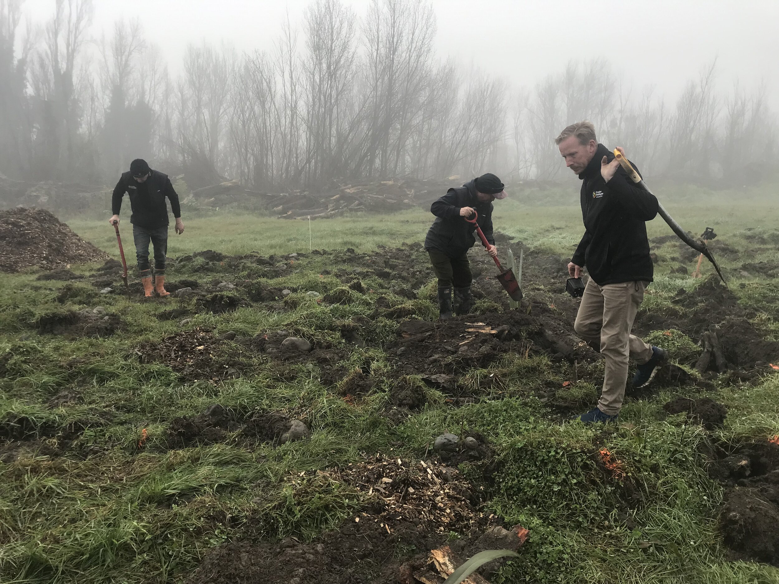


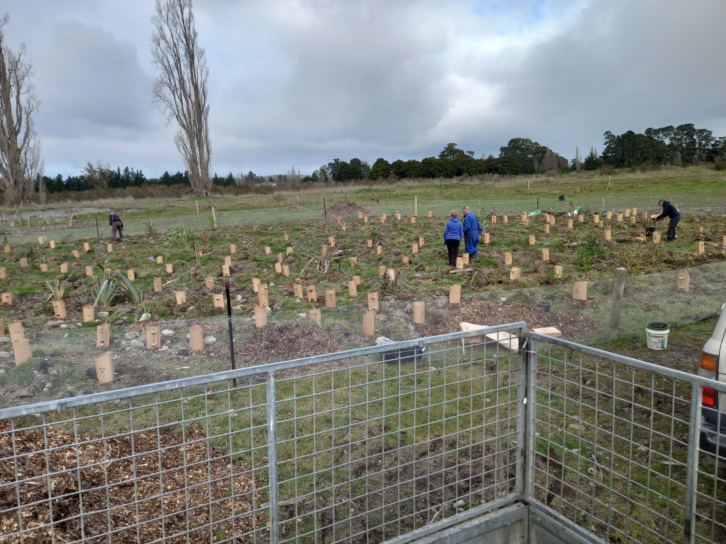


July 2021 Planting Days - Kuratawhiti Street re-wilding.
Our first planting days have been phenomenally successful. There is a worldwide shortage of NZ native trees! What to do? Around twenty folks potted up or grew from seed local native trees and donated mulch. GWRC donated posts, wire and tree protectors. Over two mornings, about forty community members and intrepid Kuranui students popped them into the cleared and prepared land at the end of Kuratawhiti Street, in carefully chosen spots under the expert guidance of Michael Roera and Bruce Slater – who with Tony Waters and Bob Chambers of the WAG project team, organized the event.
It was such a success it's looking like an annual event. Another small but vital step towards realising the community’s vision for our beautiful river.


21st June 2021 - View of SH2 Bridge showing groynes protecting Urupa and near side beach. Courtesy Bob Chambers
Heavy rain showers over the preceding few days. The river is running at approximately 240 cubic metres per second. current thinking (yep, pun intended) is that a 1% (average once every hundred year) plus climate change flood would run at approximately 2,100 cubic metres per second. The bridge is designed to handle that but the build up of gravel banks and beaches, where the gravel settles and creates an “armour layer” could be a serious threat to town, Urupa, town water supply and so on; so have to be either extracted without disturbing the water or significant flora and fauna, or encouraged to disperse when the river is high.
The Wai ō Hine I Rakahanga River Plan
The Waiōhine River Plan
Incorporating the Waiōhine FloodPlain Management Plan
Published as Draft Version 2.5 June 7th 2021
