Resources - There Are Many More linked to The Waiōhine River Plan
You can see a list of them kept on the WAG cloud, here.

The draft planting plan to naturalize the area at the end of Kuratawhiti Street and create a space to walk, rest and enjoy native flora and fauna - a Waiōhine Action Group project for the mauri of the river and our community.
This year (2023) we will be preparing and planting either side of a proposed walking track. Get involved by coming along o 11th June from 0900 for as long as you want and helping plant in the prepared areas better still, bring us your native plants and trees or come along and have a chat about the plan and what you’d like to see.
Please let friends and families know.
We love getting photos taken on the day.
If you have plants but can't make it on the day, let Tony Waters know: tony.waters1@googlemail.com or 022 190 2487 and we'll try to pick them up before the day.

Click Here to go to downloadable, scalable, printable version of this map from the WAG cloud.
This map is a study of the option for flood defences preferred by the large majority of participating community members (approximately 150) from a choice of six scenarios.
The red and green lines to the north and west of Greytown show the proposed new stop banks designed to protect from a 1% (on average once every hundred year flood, with allowance for climate change to 2100 and sensitivities, such as possioble LIDAR error, wind and wave effects etc.).
Streets and boundaries have been overlaid to help orientate the map.
The coloured (orange, yellow, green) areas outside the flood defences, show the probable effect on flood depth caused by the proposed new flood defences.
People said they liked this option as it offered the best combination of least dwellings affected, relatively low cost to build and maintain and allowed the river to behave more naturally where practicable.
Want more information about this? - Check out the Waiohine River Plan, CLICK HERE
Want to ask questions or give feedback? - EMAIL US HERE

This 1993 gem of a book is a comfortable browse, sitting in a comfy armchair upstairs in Greytown Library. It is packed with information about the story of our river, interviews with well known local river experts, superb maps and illustrations and a few surprises between it’s covers. Thoroughly recommended as entertainment and an important chapter in the story of our community, floods, flood control and hwo we have lived with the mighty Waiohine.

Aerial photos

Maps of options for flood protection.
Six alternative models of possible flood defence strategies were developed, with a lot of supporting investigations, models and maps.
Maps of the different flood protection scenarios and slides for their analysis - click here
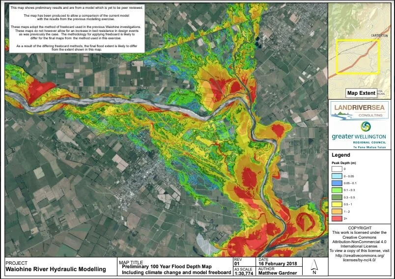
Here’s what a 1% - or 1 in 100 year on average flood might look like, with climate change, if there were no fnew flood defences
More Historic Photos

Photo Above: Bruce Slater was away that day.
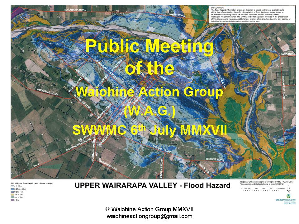
Slides from the Public Meeting that Kicked the Project Off
After a year of persuading GWRC that all was not well with the draft floodplain management plan tabled in 2016, everybody (the community, Iwi, stakeholders and District Councils agreed a totally fresh approach was needed. At this pubilc meeting, 200 community members elected unanimously to appoint a project team to take over the lead of the project and start afresh. GWRC agreed, so, the new approach as born.
Opening Slide